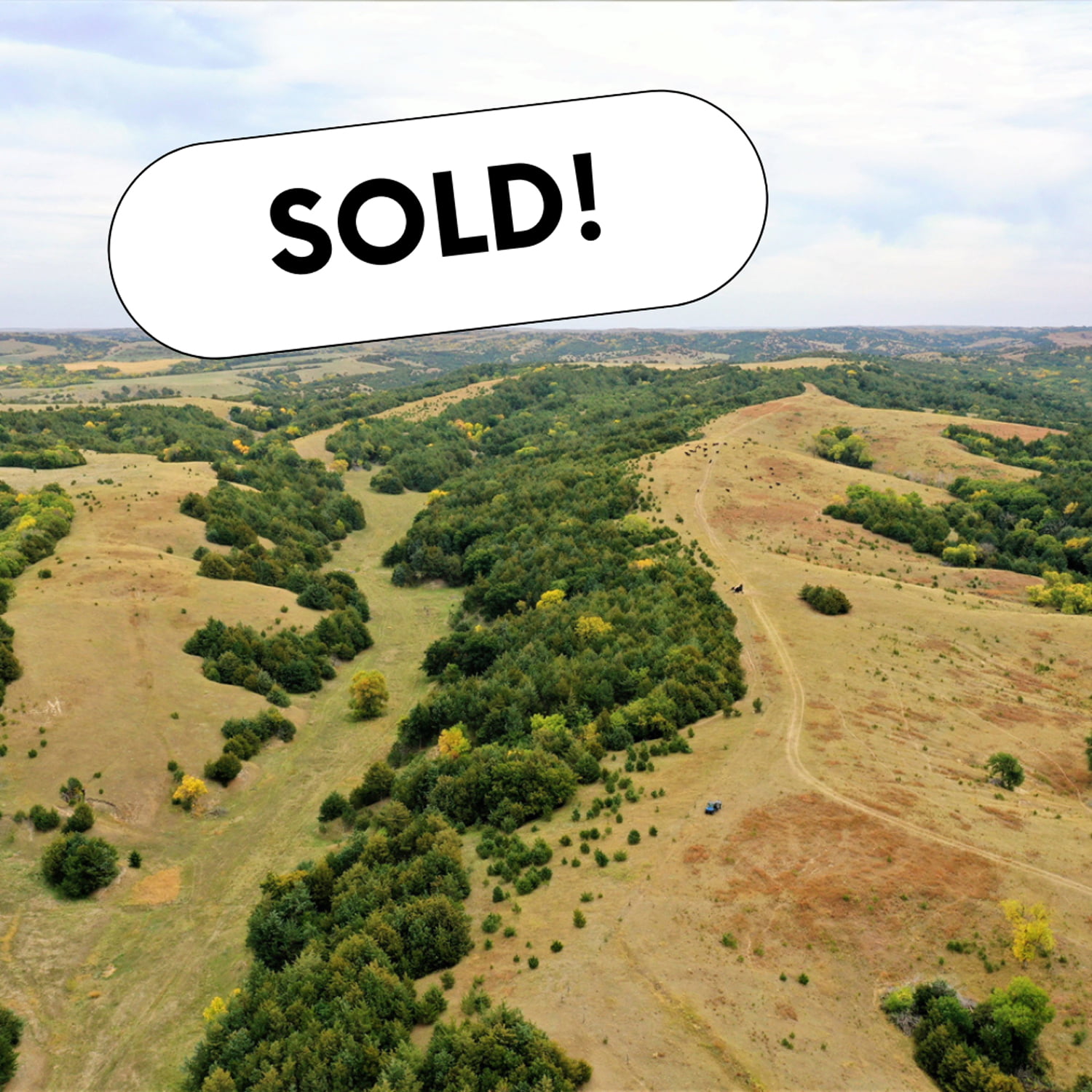
Sandhills Ranch | 707.68 +/- Acres in Sheridan County, NE

SOLD $530,760

This beautiful Sandhills property is the deer haven you have been looking for! You will not want to miss out on this opportunity!

The Nebraska Sandhills

The Sandhills region, known for its mixed-grass prairie on grass-stabilized sand dunes, covers most of the western part of Nebraska. The north end of this 707+/- acre property boasts expansive pastureland that transitions into the rolling Sandhills of Nebraska.

Throughout the Sandhills you’ll find deep pockets of terrain held in place by warm-season grasses that are brimming with mule deer throughout the year, making it an ideal spot and stock hunting paradise with great options for potential food plots.

Many species of wildlife make the Sandhills home on this property including antelope, coyotes, and sharp-tail grouse. The Sandhills acres sit atop one of the world’s largest aquifers, the Ogallala Aquifer, with power lines located within 100 yards of the fence line, making it an excellent location for building the hunting cabin of your dreams!

Ogallala Aquifer

High Plains Aquifer – Also called the Ogallala Aquifer, is an area of about 174,000 square miles and extends through parts of eight states in the Midwest. This aquifer is the principal source of water in one of the major agricultural areas of the United States.

“The Sandhills region is one of the largest contiguous and least disturbed prairies in all of the United States.”

Source: extension.unl.edu

Ranch Details

The ranch provides a great opportunity for summer grazing and income generation. The current owners of the property suggest that the grass can be used for summer grazing for up to 60 pairs in a period of 5-6 months, providing an excellent income stream. Additionally, there is the possibility of leasing out the grazing rights.

The well-maintained fences are in great condition and undergo an inspection every spring, with many new posts installed in the spring of 2022.

There are two 8 ft. windmills with new galvanized pipe, a new tire tank on the south windmill, and plastic pipe on the north windmill. A solar well with a new pump (installed in 2022) is situated in the middle of the property, between the two windmills, offering an excellent source of water for cattle throughout the property.

Legal Descriptions

Township 26 North – Range 41 West of the 6th P.M.
Section 17:E ½ (317.68 +/- Acres)
Section 20: E ½, NE ¼ (77.86 +/- Acres)
Section 21: N ½ (312.14 +/- Acres)


Sheridan47


Buyer Represented 425.73 +/- Acres in Lincoln Co, NE

Buyer Represented 425.73 +/- Acres in Lincoln Co, NE

AgWest Land Brokers, LLC represented the buyer during this land transaction.


This is an irrigated and dryland property that’s located only a short distance from North Platte, NE. This property is on top of Bushnell Canyon, which provides some of the best recreational opportunities in the area. The property mostly consist of Uly loam silt loam, Hersch fine sandy loam, and Holdrege silt loam soils.


Legal Description

Part of the North Half (½) of South Half (½) of Section Eight (8), Township Twelve (12) North, Range Twenty-Nine (29) West of the 6th PM, Lincoln County, Nebraska (To Be Determined By Survey If Needed)
West Half (½) of Northwest Quarter (¼) & Southwest Quarter (¼) of Section Ten (10), Township Twelve (12) North, Range Twenty-Nine (29) West of the 6th PM, Lincoln County, Nebraska (To Be Determined By Survey If Needed)
Part of the South Half (½) of Section Nine (9), Township Twelve (12) North, Range Twenty-Nine (29) West of the 6th PM, Lincoln County, Nebraska (To Be Determined By Survey If Needed)


Irrigation Information:

Located in the Twin Platte NRD with 133.27 certified irrigated acres.

Well G-049021 drilled in 1976

900 GPM

298 Static Level

320 Pumping Level

600 Well Depth


Lincoln10

Online Absolute Land Auction – 156 +/- Acre Combination Farm in Norton County, Kansas

SOLD  $2,950/ac

Online Absolute Land Auction

AgWest Land Brokers is proud to offer 156 +/- acres of productive dryland and grass just 2.5 miles north of Norton, KS. This incredible combination farm consists of over 94 +/- acres of premium Class II Holdrege silt loam soil spread across all tillable acres. There is no lease in place and is open to the buyers for the 2023 crop and grazing season, with immediate possession after closing! The remaining acres consist of lush grass that was not grazed in 2022, surrounded by a four-wire barbed wire fence. A submersible well is located at the north end of the farm along with a newly dug pond at the south end of the pasture, providing great sources of water for your livestock.

Bid Online at Bid.AgWestLand.com

Bidding Opens
Friday, April 14th at 10:00 am CDT

Bidding Closes
Wednesday, April 19th at 10:00 am CDT

Bidding will “soft close” and bidding will continue in five-minute increments until five minutes have passed with no new bids.

**AgWest Land Brokers agents will be present to help buyers in person on April 19th at 9 am at:

The Loft
101 S. State Street
Norton, KS 67654
(second floor)

Legal Description – NE 1/4 Less RD R/W Section 17 Township 02 South, Range 23 West

Current Leases – Open for the 2023 crop and grazing season.

Additional Property Details

  • Newly constructed 26’x96’x16′ open-faced storage shed and a small holding pen, built with new continuous fence panels just off County Road I.
  • Submersible well located at the north end of the property.
  • 2 stock tanks in good condition.
  • Four-wire barbed wire fence surrounds the pasture.

FSA Information

Total Cropland Acres: 93.55 +/-
Wheat – 20.04 Base Acres – 44 PLC Yield
Corn – 40.04 Base Acres – 92 PLC Yield
Safflower – 3.24 Base Acres – 682 PLC Yield
Soybeans – 3.19 Base Acres – 30 PLC Yield
Grain Sorghum – .05 Base Acres – 111 PLC Yield
Total Base Acres – 66.56

Norton23

Online Land Auction – 6,054.54 +/- Acres in Decatur County, KS – Offered in 7 Tracts


SOLD $9,000,000

AgWest Land Brokers is proud to offer this Decatur County, KS combination farm.  A productive cropland farm and cattle ranch located in northern Kansas.  It is nearly all-contiguous and comprises of 6,054.54+/- deeded acres in Decatur County.

This property offers 231.08 +/- acres of pivot irrigated cropland, 2,120.44 +/- acres of non-irrigated cropland, 3,701.02 +/- acres of native hardland grass, and 2 +/- acres of miscellaneous.

For the avid sportsman, many mule deer, whitetail deer, upland birds and turkey tend to travel the creek bottoms and roam the several thousand acres of open prairie this ranch has to offer. The farm is located between Oberlin, KS and McCook, NE on each side of Hwy 83 running north and south. Don’t miss this unique opportunity to own a sizable farm and ranch in northern Kansas.


Bid online at: Bid.AgWestLand.com

Online Bidding Opens

Wednesday, March 15 at 11:00 am CDT

Online Bidding Closes

Tuesday, March 21 at 11:00 am CDT

Bidding will “soft close” and bidding will continue in five-minute increments until five minutes have passed with no new bids.

AgWest Land Brokers agents will be present to help buyers in person March 21 beginning at 9:00 am:

Red Willow County Fairgrounds

West 5th Street

McCook, NE 69001


Tract 1

Non-Irrigated Cropland Acres: 99.62

Irrigated Cropland Acres: 67.75

Native Grass Acres: 587.62

Total Acres: 754.99 +/-


Legal Description

Part of Southeast 1/4 Section 2

Part of Northwest 1/4 Section 12

Part of West 1/2; North 1/2 Southeast 1/4 Section 1

All in Township 1 South, Range 29 West


Property Taxes

$4,937.39


Irrigation Information

Net Acres Authorized 97+/-

Authorized Quantity (AF) 97 +/-

Net Quantity (AF) 97 +/-

Authorized Rate (GPM) 480

Net Rate (GPM) 480

Acres Irrigated 70

Per WIMAS Water Right Information Sheet


Available Upon Request

Waterline Maps

FSA Information


Tract 2

Non-Irrigated Cropland Acres: 369.94

Native Grass Acres: 121.36

Total Acres: 491.3 +/-


Legal Description

Original Town Cedar Bluffs , Part of Section 10

West 1/2; Southeast 1/4 Section 9

All in Township 1 South, Range 29 West


Property Taxes

$4,344.47


Additional Information

Buyer to reimburse tenant for chemical application at closing

Ask broker for details


Available Upon Request

Waterline Maps

FSA Information


Tract 3

Non-Irrigated Cropland Acres: 74.83

Native Grass Acres: 9.83

Misc Acres: 1.0

Total Acres: 85.66 +/-


Legal Description

Original Town Cedar Bluffs

Part of Section 10, Township 1 South, Range 29 West


Property Taxes

$777.46


Available Upon Request

Waterline Maps

FSA Information


Tract 4

Non-Irrigated Cropland Acres: 347.28

Irrigated Cropland Acres: 86.13

Native Grass Acres: 182.89

Misc Acres 1.0

Total Acres: 617.3 +/-


Legal Description

Section 17, Township 1 South, Range 29 West


Property Taxes

$6,771.42


Irrigation Info:

Net Acres Authorized 60 +/-

Authorized Quantity (AF) 110 +/-

Net Quantity (AF) 110 +/-

Authorized Rate (GPM) 700

Net Rate (GPM) 700

Acres Irrigated 84

Per WIMAS Water Right Information Sheet


Available Upon Request

Waterline Maps

FSA Information


Additional Information

Buyer to reimburse tenant for chemical application at closing

Ask broker for details


Tract 5

Non-Irrigated Cropland Acres: 429.52

Native Grass Acres: 190.97

Total Acres: 620.49 +/-


Legal Description

Section 16, Township 1 South, Range 29 West


Property Taxes

$4,556.74


Available Upon Request

FSA Information


Tract 6

Non-Irrigated Cropland Acres: 448.56

Native Grass Acres: 1,073.98

Total Acres: 1,522.54 +/-


Legal Description

East 1/2 Less Tract Section 15

West 1/2 Section 15

Section 22

Southwest 1/4 Southwest 1/4 Section 14

Northeast 1/4; North 1/2 Northwest 1/4 Section 27

All in Township 1 South, Range 29 West


Property Taxes

$7,349.43


Available Upon Request

Waterline Maps

FSA Information


Tract 7

Non-Irrigated Cropland Acres: 350.69

Irrigated Cropland Acres: 77.2

Native Grass Acres: 1,534.37

Total Acres: 1,962.26 +/-


Legal Description

East 1/2 East 1/2; Southwest 1/4 Southeast 1/4 Section 20

Section 21

West 1/2 Southwest 1/4 Section 27

Section 28

East 1/2; East 1/2 Southwest 1/4 Section 29

Northeast 1/4 Northeast 1/4 Section 32

All in Township 1 South, Range 29 West


Property Taxes

$9,918.46


FSA Info


Irrigation Info

Net Acres Authorized 77 +/-

Authorized Quantity (AF) 140 +/-

Net Quantity (AF) 140 +/-

Authorized Rate (GPM) 500

Net Rant (GPM) 500

Acres Irrigated 75

Per WIMAS Water Right Information Sheet


Included in the Sale

6-Tower Reinke Irrigation Pivot with diesel power unit


Available Upon Request

Waterline Maps

FSA Information


Additional Information

Buyer to reimburse tenant for chemical application at closing

Buyer to receive cash rent for planted wheat acres (111 +/-)

Ask broker for details


Decatur05

Buyer Represented 80 +/- Acres Grassland & Recreational in Franklin County, KS

AgWest Land Brokers, LLC represented the Buyer during this transaction.


Property Description

Properties this size with this much to offer do not come along often. Located only a couple miles NW of Rantoul Ks., this rolling 80ac (m/l) has it all when it come to creating a top shelf recreational tract. Located at the end of a dead end road, the property comes with a rural water meter, two electric meters, a well, RV hookups, a 1000 gal septic, and several small structures to store your equipment and tools. The property also has a mobile type home that is considered of no value and could be easily removed.
But the true beauty of this property is its location and the layout of the land. One look at the aerial and the pictures and you can see the mature hardwood timber that runs throughout the property. The open fields that are located on the high ground throughout the tract, would make great food plot locations and/or ambush sites for deer, turkey and other native wildlife. A layout like this allows for multiple hunters at one time, which is not common for a smaller tract of this size. The timber is thick and mature, and has a healthy balance of both white and red oaks, hickory, and walnut trees. Providing value to the wildlife, and the new owner as well. Multiple thriving Paw Paw patches can be found on the property as well! The rolling terrain is thick deep draws that separate the hay fields on top and slope down lower native grass field and to the Marias Des Cygne river running along the northern property line. Middle Creek also cuts through the NW corner of the property right before it connects into the Marias Des Cygne. Providing an excellent fishing hole. The Flint Hills Nature trail runs along the northern boarder of the property providing its own recreational value, as well as access to the far side of your property without having to walk through the center. This property is well taken care of and has an excellent trail system running throughout allowing access to all the fields and openings. This property comes with 100% mineral rights, and future income potential from oil is likely since the neighboring properties are actively pumping. Located only 45 minutes from greater KC, and with so much to offer, this property will not disappoint. If you re looking for a premium tract that your family will enjoy for years to come.

PROPERTY DETAILS:
• Located on a dead end road.
• Property comers with 1 rural water meter, 2 electric meters, a septic tank, and several structures to store
equipment.
• RV hook ups.
• Access to Flint Hills Nature Trail.
• Located along the Marias Des Cygne River Where Middle Creek Connects. Ideal for Deer movement during
the rut.
• Mature hardwood timber including various mature Oaks and Walnut trees.
• High Density of deer and turkey.
• 80 acres m/l. (77ac taxable not the counting road easement)
• 45 minutes from Greater Kansas City.
• 5 minutes outside of Rantoul Ks

Legal Description

North ½ Northeast ¼ Section 19, Township 17 South, Range
21 East, Franklin County, Kansas (Less ROW)

Franklin05KS

71.67 +/- Acres Grassland in Phillips, KS

Located just a short drive from Phillipsburg, KS, sits 80+/- acres of rolling grass hills with several tree-filled draws carving through the property. This parcel is perfect for adding more grass to your ranch, a scenic build site in the country, or to enjoy the hunting/recreational features this property offers. With an even mix of cool and warm season grasses, along with three ponds for watering livestock, this property is ready for cattle with immediate possession at closing. This tract is surrounded by a four-wire barbed-wire fence in good condition, and is only 4 miles off US Hwy 183, offering easy access to the property. The deep draws running through the tract are filled with cedar and hardwood trees offering great wildlife habitat for the local whitetail deer and turkey in the area. 

Whether you want to add to your ranch, build a home outside of town, or own your very own hunting land, don’t miss out on this great property!


Legal Description

Southwest 1/4 Northwest 1/4 & Northwest 1/4 Southwest 1/4, Section 31 – Township 02 South – Range 18 West, Phillips County, KS


Phillips06

Online Land Auction – Bohys Canyon Rangeland – 238.00 +/- Acres in Custer County, NE


SOLD:

$2,225 / Acre


Online Land Auction – Bohys Canyon Rangeland – 238.00 +/- Acres in Custer County, NE

Bidding Opens: Monday, November 28th at 10 a.m.

Bidding Closes: Monday, December 5th at 12 Noon

AgWest Land Brokers agents will be present to help buyers in person on Monday, December 5th at 11 a.m. at:

Loup County Community Center
406 4th Street
Taylor, Nebraska 68879

Here’s a rare opportunity to purchase some prime hardland pasture located only a few miles southeast of Taylor, NE. The property consists of 238.0 +/- acres of well-managed hardland pasture that is set up with an underground waterline system feeding several tanks and hydrants. The seller has spent over $20,000 in the last couple of years managing the volunteer cedars and all interior fences have been replaced with hedgeposts and three-wire fences. There is an old field that is located in the southeast corner of the property that offers some of the most beautiful views any outdoorsman could ask for. It could be replanted to attract some of the local wildlife in the area, which includes mostly turkey, whitetail deer, mule deer, and elk. The property is owner rated at 60 cow/calf pair for a 5-month grazing season and is split into 6 different pastures situated for rotational grazing. Sellers own an additional 160 +/- acres to the north of the subject property. Buyers will be offered first-right-of-refusal on this property after purchase. Also, the sellers will allow the buyers full use of the cattle working facilities located off the gravel road to the north of the subject property. The 160 +/-acres being retained by the sellers are connected to the same waterline as the subject property. Sellers have agreed to pay the buyers $750/year for the use of the buyer’s well.

Legal Description:

Part of North ½ Northwest ¼ , Northwest ¼ Northeast ¼ , South ½ Northeast ¼ , Northeast ¼ Southeast ¼, Section Eight (8), Township Twenty (20) North, Range Seventeen (17) West of the 6th P.M., Custer County, NE.

Part of Southwest ¼ , Section Five (5), Township Twenty (20) North, Range Seventeen (17) West of the 6th P.M., Custer County, NE.

*FINAL LEGAL DESCRIPTION AND ACRES TO COME FROM COMPLETED SURVEY


Custer21

Land Auction – 239.12 +/- Acres in Merrick County, Offered in 3 Tracts

SOLD

Tract 1: $10,750 / Acre

Tract 2: $7,400 / Acre

Tract 3: $4,700


Land Auction – 239.12 +/- Acres in Merrick County

Offered in 3 Tracts

Tuesday, November 15, 2022

10:00 a.m.

VFW – Main Street

Clarks, NE


Up for auction are 3 nice laying flat farms located close to multiple elevators and an ethanol plant.

Tract 1 and Tract 2 are just across the road from each other. Each is set up for a half swing pivot with the ability to water the corners.

Tract 2 has Silver Creek running through the north part of the farm.

Tract 3 is a nice flat pivot-irrigated 80 with the ability to irrigate the corners.


Tract 1

Total Acres (Per Assessor) – 80.05 +/-

Irrigated Acres – 77.14 +/-

Dryland Acres – 1.92 +/-

Other Acres – 0.99 +/-

Real Estate Taxes – $2,882.04

Legal Description – E1/2 NW1/4 Section 26, Township 15N, Range 5W, Merrick County, Nebraska

Driving Directions – Take Hwy 30 west of Clarks to 24 Rd. Turn north and go roughly 3 miles to W Rd. Turn west and go 1/2 mile.

Property is located on south side of the road.


Irrigation Information

  • Pivot and power unit are owned by tenant and do not convey with the property. Wells to pivot set up at 650GPM. 

Irrigation Equipment – 4 Wells

  • Well 1: G-045876A drilled in Jan 1950, 1,000 gpm, 7′ static level, 26′ well depth.
  • Well 2: G-045876B drilled in May 1948, 1,000 gpm, 7′ static level, 30′ well depth
  • Well 3: G-045876C drilled in Jan 1982, 400 gpm
  • Well 4: G-045876D drilled in Jan 1982, 500 gpm

FSA Information

Total Cropland Acres: 79.53

Wheat – 11.51 Base Acres – 38 PLC Yield

Corn – 31.66 Base Acres – 160 PLC Yield

Soybeans – 6.03 Base Acres – 48 PLC Yield

Total Base Acres – 49.2

*Estimated division of base acres between

Tract 1 and Tract 2


Tract 2

Total Acres (Per Assessor) – 80.62+/-

Irrigated Acres – 77.73 +/-

Grassland Acres – 1.89 +/-

Other Acres – 1.00 +/-

Real Estate Taxes – $2,942.72

Legal Description – E1/2 SW1/4 Section 23, Township 15N, Range 5W, Merrick County Nebraska

Driving Directions – Go west of Clarks on Hwy 30 to 24 Rd. Turn north and go roughly 3 miles to W Rd. Turn west and go 1/2 mile . Property is on the north side of the road.

Irrigation Information

  • Tenant owns pivot and is not included. Wells feeding into the pivots are 650GPM.
  • 77.73 certified irrigated acres, of which 44.61 ac were issued under the Impacts Below Chapman (IBC) program in 2012 & 2013. These acres “could” be subject to needing offsets should the board deem these acres are adversely impacting Platte river stream flows. This is unlikely to happen, but these acres are subject to such rule.

Included with property:

10,000 bushel grain bin with fan and burner. Subject to lease ending September 1, 2023.

Irrigation Equipment

  • Well 1: G-045877 drilled in June 1955, 1,000 gpm, 6′ static level, 43′ well depth
  • Well 2: G-045879 drilled in June 1967, 650 gpm, 6′ static level, 30′ well depth
  • Well 3: G-163741 drilled in April 2012, 725 gpm, 7′ static level, 15′ pumping level, 30′ well depth

FSA Information

Total Cropland Acres: 75.98

Wheat – 10.99 Base Acres, 38 PLC Yield

Corn – 30.24 Base Acres – 160 PLC Yield

Soybeans – 5.77 Base Acres – 48 PLC Yield

Total Base Acres – 47.0

*Estimated division of base acres between

Tract 1 and Tract 2


Tract 3

Total Acres (Per Assessor) – 78.45 +/-

Irrigated Acres – 75.74 +/-

Grassland Acres – 0.77 +/-

Other Acres – 1.94 +/-

Real Estate Taxes – $2,765.02

Legal Description – W1/2 NW1/4 Section 1, Township 15N, Range 5W, Merrick County, Nebraska

Driving Directions – Go west of Clarks to 24 Rd. Turn north and go roughly 5 miles to Z Rd. Keep going north 1/2 mile. Property is located on the east side of the road.

Irrigation Information

  • 7 tower T&L pivot set up for roughly 250 GPM

Irrigation Equipment

  • Well 1: G-050752 drilled in May 1976, 230 gpm, 8′ static level, 30′ pumping level, 34′ well depth.
  • Well 2: G-105390 drilled in Jan 1960, 200 gpm, 6′ static level, 34′ pumping level
  • Well 3: G-140750 drilled in June 2006, 250 gpm, 10′ static level, 22′ pumping level, 33′ well depth

FSA Information

Total Cropland Acres: 75.55

Wheat – 5.0 Base Acres 38 PLC Yield

Corn – 52.0 Base Acres – 160 PLC Yield

Total Base Acres – 57.0


_Merrick21,22,23

Buyer Represented 158.40 +/- Acres, 2 Bed 2 Bath in Logan County, NE

AgWest Land Brokers, LLC represented the Buyer during this transaction.

Property Description

Beautiful acreage with income opportunities! Here is the chance to own your very own hobby farm/ranch in Logan County Nebraska. The property features 158.4 +/- acres that consists of approximately 15.4 acres of dryland that’s currently planted to corn, 86 acres of previous cropland that has recently been seeded to a grass/hay mix, with the remaining 57 acres as rangeland with a newer solar well and tire tank.

This property also offers a recently updated 2 bed 2 bath home built in 1978 with a total 1,350 sq. ft. of living space. Other features include multiple outbuildings for storage, a barn with electricity and small catch pen with automatic water, and great gravel road access.

Legal Description

Northeast Quarter of Section 28, Township 17 North, Range 28 West of the 6th P.M., 158.4 +/- Acres in Logan County Nebraska

Logan06