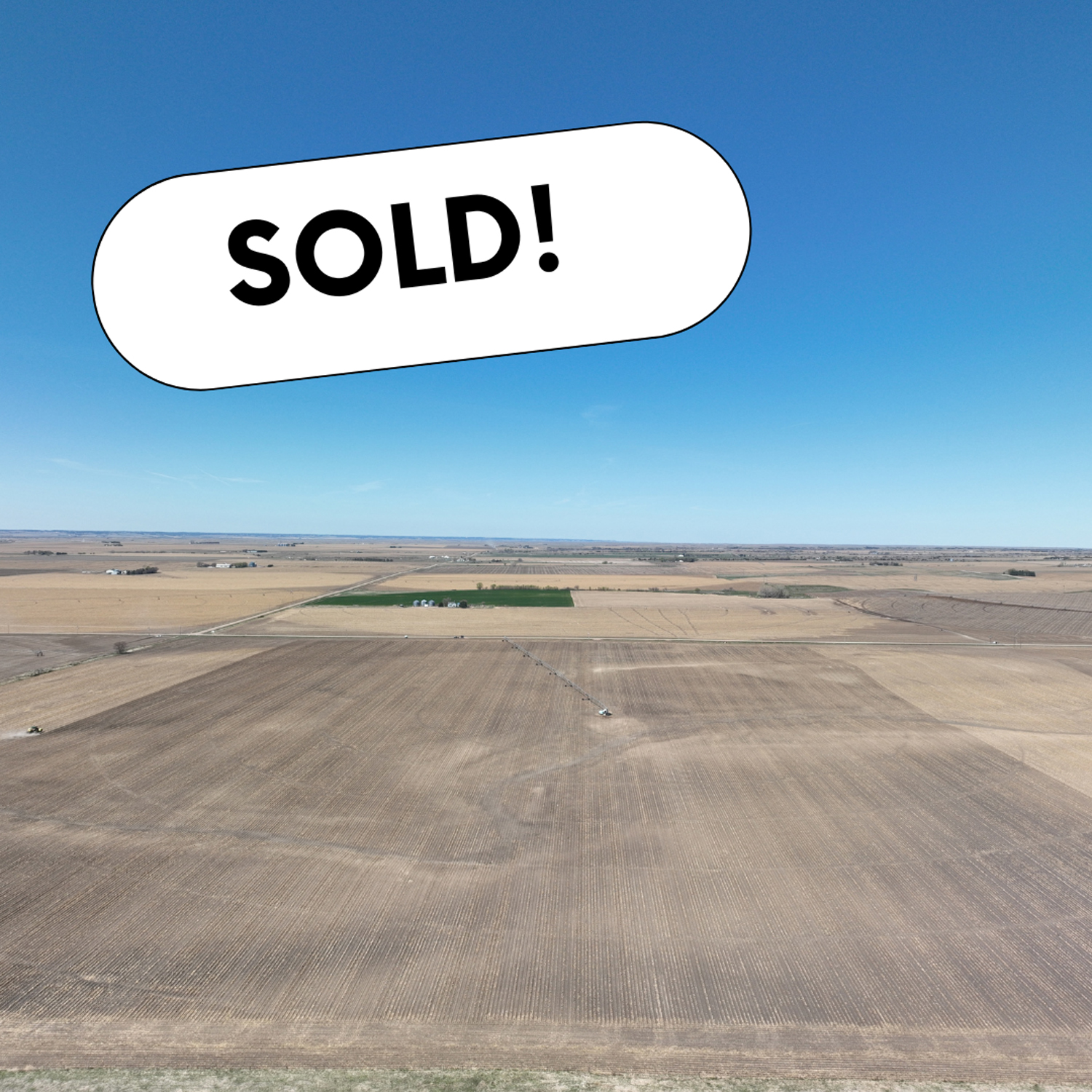
A great opportunity to add an outstanding pivot-irrigated farm to your land holdings. The farm is located in Dawson County, which is known for its fertile soil for crop production. This farm offers good access off a gravel road, is near several competitive grain markets and includes all electric irrigation equipment with the sale. A majority of the farm is comprised of productive Cozad silt loam soils.
AgWest Land Brokers is proud to offer this Decatur County, KS combination farm. A productive cropland farm and cattle ranch located in northern Kansas. It is nearly all-contiguous and comprises of 6,054.54+/- deeded acres in Decatur County.
This property offers 231.08 +/- acres of pivot irrigated cropland, 2,120.44 +/- acres of non-irrigated cropland, 3,701.02 +/- acres of native hardland grass, and 2 +/- acres of miscellaneous.
For the avid sportsman, many mule deer, whitetail deer, upland birds and turkey tend to travel the creek bottoms and roam the several thousand acres of open prairie this ranch has to offer. The farm is located between Oberlin, KS and McCook, NE on each side of Hwy 83 running north and south. Don’t miss this unique opportunity to own a sizable farm and ranch in northern Kansas.
Legal Description – Northeast 1/4 Section 10, Township 3 North, Range 18 West
Well Information – G-068080, drilled March 1982, 1,400 gpm, 191′ static level, 221′ pumping level, 320′ well depth.
Irrigation Information – 10-tower Zimmatic pivot, Caterpillar power unit, diesel tanks, gearhead, well shed, and generator included.
Located in the Lower Republican NRD and has certified irrigation rights for 131.2 acres. Water use in the area is regulated and the 2023 allocation for the next five years is 45″. In addition, the farm has 9″ of carryover from the previous allocation. For more information, please contact the Lower Republican Natural Resources District, (308) 928-2182.
Driving Directions – From Holdrege, NE travel south on Highway 183 for 13 miles and head east on 719 Road for 2 miles. The farm will be on the southwest corner of 719 Road and P Road.
Legal Description – Northwest 1/4 Section 11, Township 3 North, Range 18 West
Well Information – G-068081, drilled April 1982, 1,640 gpm, 147′ static level, 167′ pumping level, 280′ well depth.
Irrigation Information – 10-tower Zimmatic pivot, Catepillar power unit, diesel tanks, gearhead, well shed, and generator included.
Located in the Lower Republican NRD and has certified irrigation rights for 132 acres. Water use in the area is regulated and the 2023 allocation for the next five years is 45″. In addition, the farm has 9″ of carryover from the previous allocation. For more information, please contact the Lower Republican Natural Resources District, (308) 928-2182.
Additional Information – 20,000 +/- bushel grain bin included in the sale.
Driving Directions – From Holdrege, NE travel south on Highway 183 for 13 miles and head east on 719 Road for 2 miles.The farm will be on the southeast corner of 719 Road and P Road.
Legal Description – East 1/2 Southwest 1/4 Section 11, East 1/2 Northwest 1/4 & Northeast 1/4 Southwest 1/4 Section 14, all in Township 3 North, Range 18 West
Well Information – A-005435, Drilled July 1953, 1,000 gpm
Irrigation Information – 8-tower Valley pivot, Caterpillar power unit, diesel tanks, gearhead, well shed, and generator included.
Located in the Lower Republican NRD and has certified irrigation rights for 149.1 acres. Water use in the area is regulated and the 2023 allocation for the next five years is 45″. In addition, the farm has 9″ of carryover from the previous allocation. For more information, please contact the Lower Republican Natural Resources District, (308) 928-2182.
Driving Directions – From Holdrege, NE travel south on Hwy 183 for 13 miles and head east on 719 Road for 2 miles, travel south 1 mile to 718 Road and head east a 1/4 mile.The farm will be on the north and south side of 718 Road.
FSA Information
Total Cropland Acres: 468.3
Wheat – 70.8 Base Acres – 48 PLC Yield
Corn – 356.1 Base Acres – 187 PLC Yield
Grain Sorghum – 35.1 Base Acres – 79 PLC Yield
Total Base Acres: 462
**Base acres from all tracts are combined. Base acres to be prorated across all acres after closing.
AgWest Land Brokers is proud to offer 2 tracts of top-notch, irrigated farmland in Phelps County that offer productive Holdrege Silt Loam soils and are well-located near several competitive grain markets.The auction will consist of 297.832 +/- acres (per assessor). These properties are a great addition to any operation!
Tract 1 – 140.907 +/- Acres (Per Assessor)
Irrigated Acres – 136.692 +/-
Grassland/Other Acres – 4.215 +/-
Real Estate Taxes – $9,771.86
Legal Description – Pt. Southwest 1/4 Section 11, Township 5 North, Range 19 West
Irrigation Information –Located in the Tri-Basin Natural Resource District and has certified irrigation rights for 136.692 acres.
Irrigation Equipment
Well G-024222 drilled in June 1965, 1,000 gpm, 226′ static level, 250′ pumping level, 270′ well depth.
Pivot, power unit, tanks, pipe, surge valve, well shed and filter at pivot point owned by current tenant.
FSA Information
Total Cropland Acres: 135.19
Corn – 133.6 Base Acres – 187 PLC Yield
Total Base Acres – 133.6
Driving Directions – From Holdrege, travel approximately 2.5 miles southwest on Highway 6/34 to 730 Road. Head west 1.5 miles to J Road. The farm will be on the northeast corner of J Road and 730 Road.
Tract 2 – 156.925 +/- Acres (Per Assessor)
Irrigated Acres – 141.831 +/-
Dryland Acres – 6.063 +/-
Grassland/Other Acres – 9.031 +/-
Real Estate Taxes – $9,669.36
Legal Description – Southwest 1/4 Section 14, Township 5 North, Range 19 West
Irrigation Information – Located in the Tri-Basin Natural Resource District and has certified irrigation rights for 141.831 acres.
Irrigation Equipment
Well G-020404 drilled in May 1959, 1,200 gpm, 208′ static level, 215′ pumping level, 272′ well depth.
Electric well motor, pivot, tanks, pipe, well shed and variable frequency drive owned by current tenant.
FSA Information
Total Cropland Acres: 148.51
Corn – 82.07 Base Acres – 193 PLC Yield
Soybeans – 61.89 Base Acres – 61 PLC Yield
Total Base Acres – 143.96
Driving Directions – From Holdrege, travel approximately 2.5 miles southwest on Highway 6/34 to 730 Road. Head west 1.5 miles to J Road and travel 1/2 mile south on J Road. The farm will be on the east side of the road.
Johnson Center
509 Main Street
Alma, Nebraska 68920
Up for auction is an outstanding dryland farm in Harlan County, Nebraska.This farm offers 86% Holdrege silt loam soils with good access off a gravel road.This top-quality farm is located south of Stamford, Nebraska, and is a great opportunity to own a nice laying and well cared for farm!
Legal Description – Northeast 1/4 Section 30, Township 1 North, Range 20 West
FSA Information
Total Cropland Acres: 157.51
Wheat – 102.7 Base Acres – 51 PLC Yield
Corn – 4.4 Base Acres – 115 PLC Yield
Grain Sorghum – 26.6 Base Acres – 114 PLC Yield
Soybeans – 0.4 Base Acres – 59 PLC Yield
Friday, October 14th at 1:30 p.m.
Custer County Fairgrounds | 4-H Building
44100 Memorial Drive
Broken Bow, NE 68822
640.61 +/- Acresoffered in 2 tracts or as an entire parcel
Centrally located hardland pasture that would be a great addition to any cattle operation. For the avid outdoorsman, there is outstanding recreational potential.Access to the property is by township road located on the west side. Currently, water is supplied by one windmill and water wells from neighboring properties.
Legal Descriptions –North 1/2 Section 16, Township 15 North, Range 21 West; South 1/2 Northeast 1/4 & Southeast 1/4 Section 8, Township 15 North, Range 21 West; North 1/2 Northeast 1/4 Section 17, Township 15 North, Range 21 West
Water Wells – Three windmills are located on the property.Two of the three windmills are not working. There are three tanks on the property where water is supplied from the neighbors’ wells.All water tanks are owned by the tenant.