


PROPERTY DESCRIPTION
SOLD:
Tract 1 – $8,250 / Acre
Tract 2 – $8,250 / Acre
Tract 3 – $7,200 / Acre
Land Auction – 528 +/- Total Acres Offered in 3 Tracts
Thursday, December 1st at 10 a.m.
Phelps County Ag Center
1308 2nd Street
Holdrege, NE 68949
Bid Online at Bid.AgWestLand.com
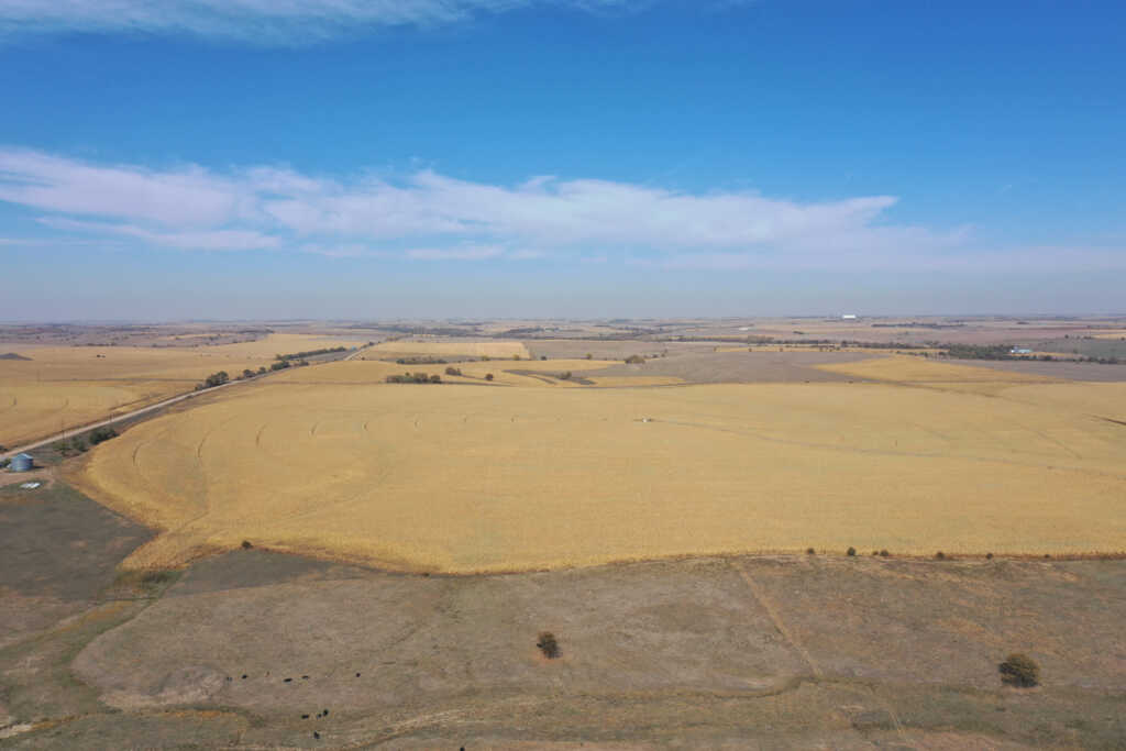
Productive irrigated farms located in a strong farming community.
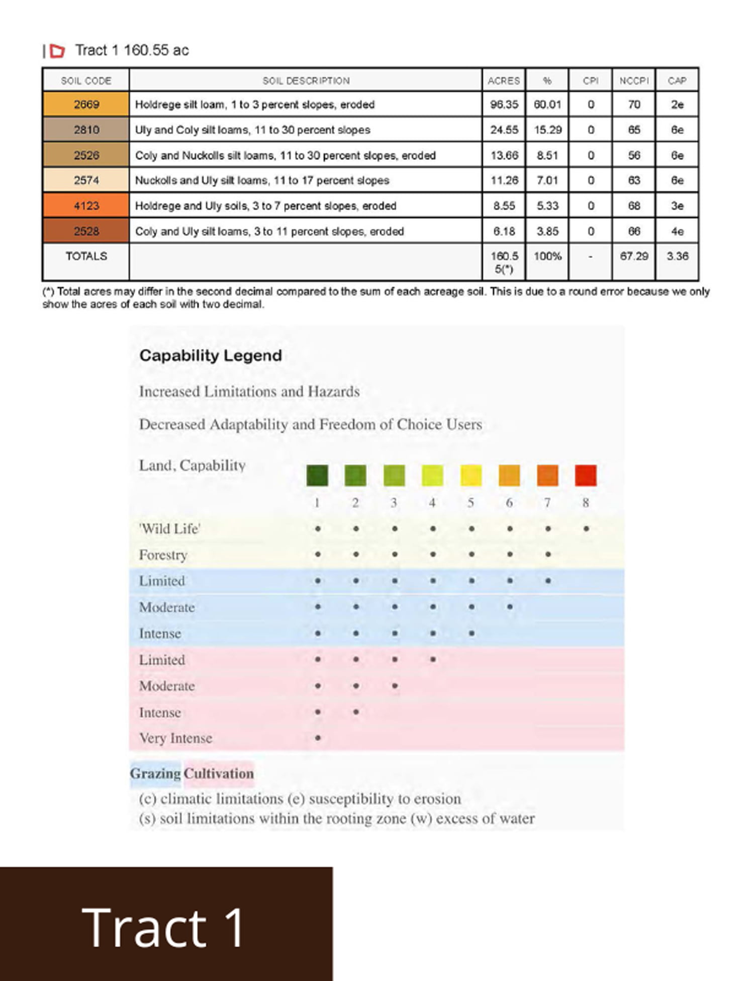
Tract 1 – 161 +/- Acres
Irrigated Acres – 133.00 +/-
Dryland Acres – 12.00 +/-
Grass Acres – 12.00 +/-
Other Acres – 4.00 +/-
Real Estate Taxes – $ 5,291.88
Legal Description – Northeast 1/4 Section 10, Township 3 North, Range 18 West
Well Information – G-068080, drilled March 1982, 1,400 gpm, 191′ static level, 221′ pumping level, 320′ well depth.
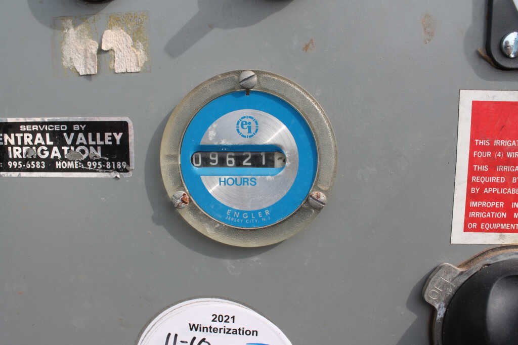
Irrigation Information – 10-tower Zimmatic pivot, Caterpillar power unit, diesel tanks, gearhead, well shed, and generator included.
Located in the Lower Republican NRD and has certified irrigation rights for 131.2 acres. Water use in the area is regulated and the 2023 allocation for the next five years is 45″. In addition, the farm has 9″ of carryover from the previous allocation. For more information, please contact the Lower Republican Natural Resources District, (308) 928-2182.
Driving Directions – From Holdrege, NE travel south on Highway 183 for 13 miles and head east on 719 Road for 2 miles. The farm will be on the southwest corner of 719 Road and P Road.
Tract 2 – 161 +/- Acres
Irrigated Acres – 132.00 +/-
Dryland Acres – 16.00 +/-
Grass Acres – 8.00 +/-
Other Acres – 5.00 +/-
Real Estate Taxes – $ 5,398.29
Legal Description – Northwest 1/4 Section 11, Township 3 North, Range 18 West
Well Information – G-068081, drilled April 1982, 1,640 gpm, 147′ static level, 167′ pumping level, 280′ well depth.
Irrigation Information – 10-tower Zimmatic pivot, Catepillar power unit, diesel tanks, gearhead, well shed, and generator included.
Located in the Lower Republican NRD and has certified irrigation rights for 132 acres. Water use in the area is regulated and the 2023 allocation for the next five years is 45″. In addition, the farm has 9″ of carryover from the previous allocation. For more information, please contact the Lower Republican Natural Resources District, (308) 928-2182.
Additional Information – 20,000 +/- bushel grain bin included in the sale.
Driving Directions – From Holdrege, NE travel south on Highway 183 for 13 miles and head east on 719 Road for 2 miles. The farm will be on the southeast corner of 719 Road and P Road.
Tract 3 – 206 +/- Acres
Irrigated Acres – 149.00 +/-
Grass Acres – 55.00 +/-
Other Acres – 2.00 +/-
Real Estate Taxes – $ 7,077.03
Legal Description – East 1/2 Southwest 1/4 Section 11, East 1/2 Northwest 1/4 & Northeast 1/4 Southwest 1/4 Section 14, all in Township 3 North, Range 18 West
Well Information – A-005435, Drilled July 1953, 1,000 gpm
Irrigation Information – 8-tower Valley pivot, Caterpillar power unit, diesel tanks, gearhead, well shed, and generator included.
Located in the Lower Republican NRD and has certified irrigation rights for 149.1 acres. Water use in the area is regulated and the 2023 allocation for the next five years is 45″. In addition, the farm has 9″ of carryover from the previous allocation. For more information, please contact the Lower Republican Natural Resources District, (308) 928-2182.
Driving Directions – From Holdrege, NE travel south on Hwy 183 for 13 miles and head east on 719 Road for 2 miles, travel south 1 mile to 718 Road and head east a 1/4 mile. The farm will be on the north and south side of 718 Road.
FSA Information
Total Cropland Acres: 468.3
Wheat – 70.8 Base Acres – 48 PLC Yield
Corn – 356.1 Base Acres – 187 PLC Yield
Grain Sorghum – 35.1 Base Acres – 79 PLC Yield
Total Base Acres: 462
**Base acres from all tracts are combined. Base acres to be prorated across all acres after closing.
Harlan09
PROPERTY LOCATION
Latitude: 40.24552 / Longitude: -99.33531
The information contained herein is as obtained by AgWest Land Brokers LLC—Holdrege, NE from the owner and other sources. Even though this information is considered reliable, neither broker nor owner make any guarantee, warranty or representation as to the correctness of any data or descriptions. The accuracy of such statements should be determined through independent investigation made by the prospective purchaser. This offer for sale is subject to prior sale, errors and omissions, change of price, terms or other conditions or withdrawal from sale in whole or in part, by seller without notice and at the sole discretion of seller. Readers are urged to form their own independent conclusions and evaluations in consultation with legal counsel, accountants, and/or investment advisors concerning any and all material contained herein. Maps are for illustrative purposes only and are not intended to represent actual property lines.
PROPERTY INFORMATION
Total Acres: 528
Irrigated Acres: 414
Dryland Acres: 28
Grass Acres: 75
Taxes: $17,767
Mineral Rights: all owned convey