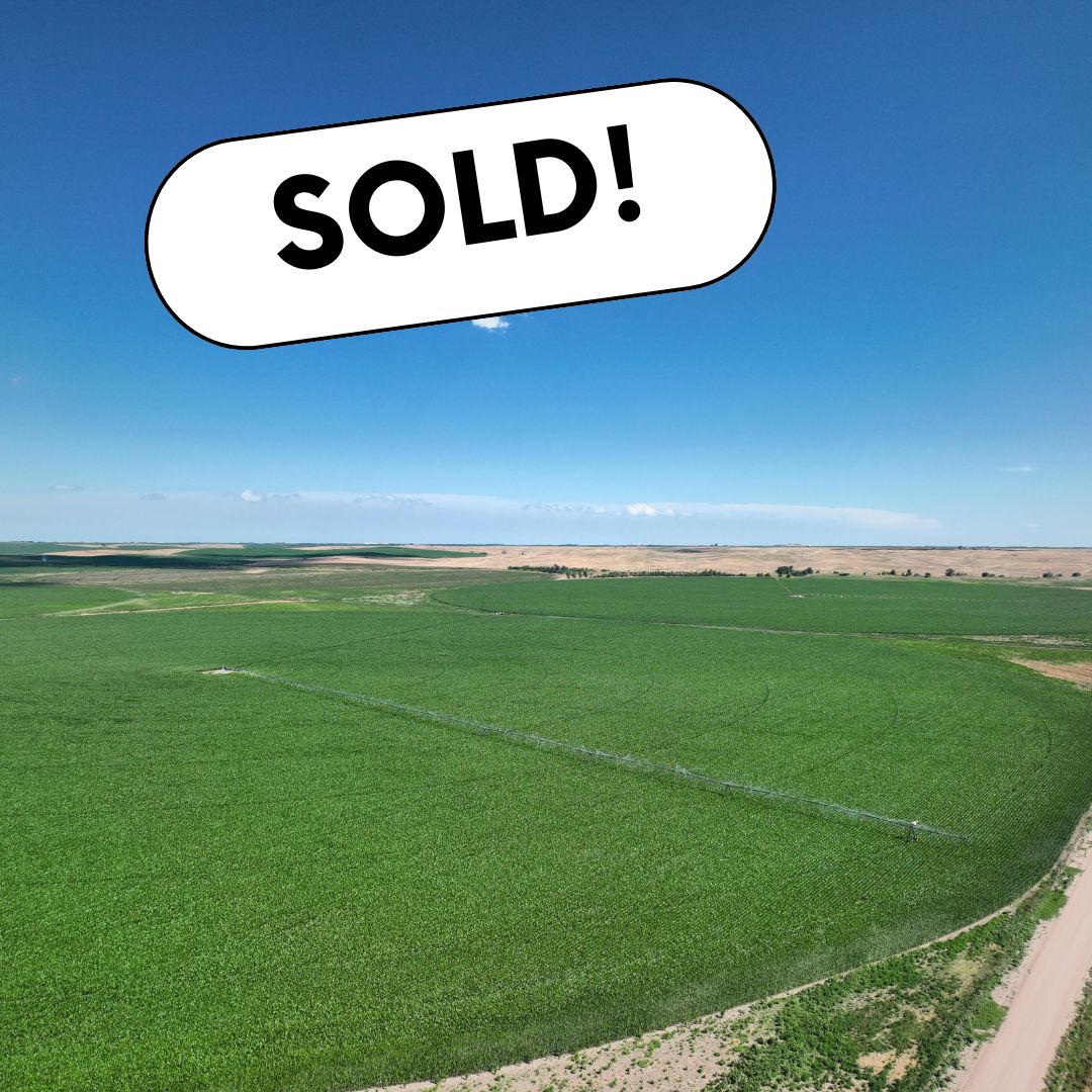
A premier irrigated farm that has been built over generations. This farm offers productive irrigated land that is nearly all contiguous. Fertile soils and abundant water make this western Nebraska irrigated farm a tremendous opportunity for an existing farming operation or investor.
Great opportunity to add one (or two!) irrigated farms to your land holdings. These farms offer good water and productive soils. Natural gas power units and electric pivots allow for efficient and timely irrigation throughout the summer. Well-maintained gravel roads give good access for equipment. These are two nice farms for any farming operation or land portfolio!
TRACT 1 – West Quarter – $1,640,000
LEGAL DESCRIPTION – Southwest ¼ of Section 31, T13N, R16W, Sherman County, NE
PROPERTY TAXES (2025) – $6,042.54
TOTAL ACRES (per assessor) – 160+/-
Irrigated Acres – 127.6+/-
Dryland Acres – 17.3+/-
Grass Acres – 11.1+/-
Other Acres – 4+/-
IRRIGATION INFORMATION
Well G-063258
Drilled in 1980, 750′ GPM, 73′ Static Level, 170′ Pumping Level, 418′ Well Depth
Included with the sale: natural gas power unit and electric irrigation pivot
Located in the Lower Loup NRD
127.61 Certified Irrigation Acres
TRACT 2 – East Quarter – $1,640,000
LEGAL DESCRIPTION – Southeast ¼ of Section 31, T13N, R16W, Sherman County, NE
PROPERTY TAXES (2025) – $6,114.02
TOTAL ACRES (per assessor) – 160+/-
Irrigated Acres – 130+/-
Dryland Acres – 15+/-
Grass Acres – 4+/-
Other Acres – 11+/-
IRRIGATION INFORMATION
Well G-001875
Drilled in 2006, 750′ GPM, 46′ Static Level, 163′ Pumping Level, 390′ Well depth.
Included with the sale: natural gas power units
2017 8 Tower Irrigation Pivot, 725 GPM at 45 PSI
Located in the Lower Loup NRD
130 Certified Irrigated Acres
FSA Information (for both tracts) – 303.55 Cropland Acres
Prime Property for Sale with Excellent Location and High Development Potential
Located on the northeast side of exit 279 on Interstate 80 and Highway 10, this property boasts a highly desirable location. Thousands of vehicles pass by every day on these well-traveled roads, making it an ideal location for development. The property is conveniently located 170 miles west of Omaha and 360 miles east of Denver, making it an attractive destination for potential buyers. The seller has listed this property for sale subject to an access easement that runs with the land for the benefit of the seller and seller’s successors and assigns.
Legal Description
Part of lots 6, 8, 9 & 10 of N1/2 SW 1/4 Section 6 Township 8 North Range 14 West of the 6th P.M.
Irrigation Information
Located in the Central Platte NRD and has certified irrigation rights for 51.35 acres.
Irrigation Equipment
Well G-012349: drilled in May 1985, 1,100 gpm, 7′ static level, 20′ pumping level, 65′ well depth.
Additional Information
Recent demolition of house and barn previously on the property.
All tracts are subject to cash rent lease. For full FSA information, see Additional Property Information. Additional property documents can be viewed at bid.agwestland.com.
Tract 1 – Combination Farm
This is a sizable combination farm that has a good mix of non-irrigated cropland and pasture. Roads around the majority of the farm allow for good access. The pasture is well-fenced, with cross fencing to allow for rotational grazing. Several ponds and dams provide water for livestock throughout the pasture. Additionally, there is a well located at the southern end of the property within the corrals, which is powered by a solar panel. The solar panel is owned by the tenant and is not included in the sale. All water tanks that hold water are owned by the tenant and are not included in the sale.
Cash Rent Lease: Buyer to be assigned the current cash rent lease. Seller to retain the first one-half (1/2) ($18,648.50) cash rent and Buyer to receive the second one-half (1/2) ($18,648.50) cash rent when due from tenant.
Tract 2 – Dryland Farm This is a nice laying dryland farm that offers productive soils. Roads to the north and east allow for good access. This would be a nice farm for any investor or farming operation.
Total Acres (Per Assessor) – 122 +/-
• Dryland Acres – 118 +/-
• Other Acres – 4 +/-
Cash Rent Lease: Buyer to be assigned the current cash rent lease. Seller to retain the first one-half (1/2) ($4,307.00) cash rent and Buyer to receive the second one-half (1/2) ($4,307.00) cash rent when due from tenant.
Tract 3 – Combination Farm
This farm is predominantly made up of hardland grass with good fences. The pasture is cross-fenced to allow for rotational grazing. The balance of the farm is productive non-irrigated cropland that offers Holdrege silt loam soils and has good access off a minimum maintenance road. Water tanks that hold water are owned by the tenant and are not included in the sale.
Cash Rent Lease: Buyer to be assigned the current cash rent lease. Seller to retain the first one-half (1/2) ($7,045.19) cash rent and Buyer to receive the second one-half (1/2) ($7,045.19) cash rent when due from tenant.
Livestock Water Well/Tanks: Historically water has been provided by a well located on the E1/2SE1/4 Section 12, T1N, R22W. Buyer understands that this water may not be provided or available to subject property after closing. Tenant owns water tanks that hold water.
Tract 4 – Dryland Farm
This dryland farm is located right off a minimum-maintenance road and would be a nice farm to add to any investor’s land portfolio or farming operation.
Cash Rent Lease: Buyer to be assigned the current cash rent lease. Seller to retain the first one-half (1/2) ($11,212.44) cash rent and Buyer to receive the second one-half (1/2) ($11,212.44) cash rent when due from tenant.
Livestock Water Well/Tanks: Historically water has been provided by a well located on the E1/2SE1/4 Section 12, T1N, R22W. Buyer understands that this water may not be provided or available to subject property after closing. Tenant owns water tanks that hold water.
Tract 5 – Dryland Farm This is a very nice dryland farm with productive soils, is located off good gravel roads, and would make a great addition to any farming operation.
Total Acres ( Per Assessor) – 80 +/-
• Dryland Acres – 74 +/-
• Other Acres – 6 +/-
Cash Rent Lease: Buyer to be assigned the current cash rent lease. Seller to retain the first one-half (1/2) ($2,701.00) cash rent and Buyer to receive the second one-half (1/2) ($2,701.00) cash rent when due from tenant.
Tract 6 – Dryland Farm
This would be a great farm to add to your land holdings. It’s a predominantly tillable farm that is well-drained and offers good access off a well-maintained road.
Subject to an easement for use and maintenance of the irrigation well located on the property that provides water to a different tract. The tenant owns the AgSense pivot monitoring equipment.
Total Acres ( Per Assessor) – 80 +/-
Dryland Acres – 62.67 +/-
Grassland Acres – 13.76 +/-
Other Acres – 3.57 +/-
Cash Rent Lease: Buyer to be assigned the current cash rent lease. Seller to retain the first one-half (1/2) ($2,287.46) cash rent and Buyer to receive the second one-half (1/2) ($2,287.46) cash rent when due from tenant.
Tract 7 – Dryland Farm
This is an outstanding farm that offers productive bottom ground. There is approximately a 1/2 mile of the Sappa Creek that meanders through the property with excellent hunting habitat. Located on a nice gravel road.
Subject to an easement for use and maintenance of the irrigation well located on the property that provides water to a different tract. The tenant owns the AgSense pivot monitoring equipment.
Total Acres ( Per Assessor) – 75.52 +/-
Dryland Acres – 66.02 +/-
Other Acres – 9.5 +/-
Estimated Property Taxes – $1,382.00
Legal Description – SE1/4SW1/4 & Pt. SW1/4SE1/4 Section 12-T1N-R22W;
Cash Rent Lease: Buyer to be assigned the current cash rent lease. Seller to retain the first one-half (1/2) ($2,336.00) cash rent and Buyer to receive the second one-half (1/2) ($2,336.00) cash rent when due from tenant.
Tract 8 – Dryland/Irrigated Farm
This farm has it all with abundant wildlife habitat and productive bottom ground along nearly 4,000 ft. of Sappa Creek running through the property. On the south side of the road is a nearly level irrigated farm with 7 tower electric Reinke pivot. The farm is irrigated with 3 irrigation wells located on different tracts. The tenant owns the AgSense pivot monitoring equipment.
Total Acres ( Per Assessor) – 305 +/-
Dryland Acres – 69.75 +/-
Irrigated Acres – 194.4 +/-
Grassland Acres – 31.85 +/-
Other Acres – 9 +/-
Cash Rent Lease: Buyer to be assigned the current cash rent lease. Seller to retain the first one-half (1/2) ($23,392.92) cash rent and Buyer to receive the second one-half (1/2) ($23,392.92) cash rent when due from tenant.
Livestock Water Well/Tanks: Historically water has been provided by a well (house well) located on the E1/2SE1/4 Section 12, T1N, R22W. Buyer understands that this water may not be provided or available to subject property after closing. Tenant owns water tanks that hold water.
Subject to an easement for use and maintenance of a house well located on the property that provides water to a different tract.
Irrigation Information
Located in the Lower Republican Natural Resource District and has certified irrigation rights for 194.4 acres. There is a water allocation of 45 inches for a 5-year period. For the 2023-2027 period, 42.4 +/- inches remain (per NRD).
Irrigation Equipment
• 1996, 7 tower Reinke pivot
• Well G-014198A – drilled in 2003, 300 gpm, 18′ static level, 42′ pumping level, 52′ well depth
• Well G-014198B – drilled in 2014, 950 gpm, 42′ static level, 58′ pumping level, 75′ well depth
• Well G-014198C – drilled in 1980, 350 gpm, unknown static level, unknown pumping level, unknown well depth
*Buyer to pay for any pivot or well repair needed after closing.
Tract 9 – Pivot-Irrigated Farm
This is a well-laying pivot irrigated farm with productive silt loam soils and is located off a gravel road. A portion of the farm has the Sappa Creek running through it, offering good wildlife habitat.
Total Acres ( Per Assessor) – 100 +/-
• Dryland Acres – 33 +/-
• Irrigated Acres – 62 +/-
• Other Acres – 5 +/-
Cash Rent Lease: Buyer to be assigned the current cash rent lease. Seller to retain the first one-half (1/2) ($7,869.50) cash rent and Buyer to receive the second one-half (1/2) ($7,869.50) cash rent when due from tenant.
Irrigation Information
Located in the Lower Republican Natural Resource District and has certified irrigation rights for 62 acres. There is a water allocation of 45 inches for a 5-year period. For the 2023-2027 period, 42.4+/- inches remain (per NRD).
Irrigation Equipment
• 2018, 7 tower Reinke pivot
• Diesel power unit
• Well G-086715 – drilled in 1995, 400 gpm, 27′ static level, 42′ pumping level, 60′ well depth
*Buyer to pay for any pivot or well repair needed after closing.
Tract 10 – 6.48 +/- Acres – Modern Country Living: Beautiful Home With Endless Views!
Discover the perfect blend of comfort and country living in this expansive ranch-style home, ideally situated within the esteemed Southern Valley School District. This single-family residence offers 4 bedrooms and 3 bathrooms, thoughtfully designed to accommodate both relaxation and entertainment. Embrace the tranquility and charm of country living without sacrificing modern conveniences. This property offers a unique opportunity to enjoy a spacious, well-equipped home in a beautiful natural setting.
Total Acres – 6.48 +/-
Estimated Property Taxes – 4,574.00
Property Address – 43169 Road 706, Beaver City, NE 68926
Home Features
• Generous Living Space: With 3,062 sq. ft. of well-appointed living area, this home provides ample room for family gatherings and personal retreats.
• Bedrooms & Bathrooms: Four spacious bedrooms and three bathrooms ensure comfort and privacy for all family members.
• Partially Finished Basement: The partially finished basement offers versatile space, perfect for a recreation room, home office, or additional storage.
• Climate Control: Equipped with a heat pump, maintaining a comfortable indoor environment year-round is effortless. The furnace and water heater are fueled by propane.
• Square Footage: 2,070 +/- sq. ft. basement below grade / subterranean with 930 +/- sq. ft. finished. 2,132 +/- sq. ft. above grade finished.
• Other Amenities: The house includes a central vacuum system and is connected to a septic system.
Outdoor Amenities
• Two-Car Garage: Provides convenient and secure parking with ample storage space.
• 30′ x 60′ Outbuilding: This substantial outbuilding is ideal for a workshop, additional storage, or hobby space.
• Mature Shade Trees: Enhance the property’s beauty and offer cool, shaded areas for outdoor enjoyment.
• Abundant Wildlife: Nature enthusiasts will appreciate the frequent visits from local wildlife, adding to the serene country atmosphere.
• Scenic Views: Experience stunning sunrises and sunsets from the comfort of your home, with picturesque landscapes stretching as far as the eye can see.
Location Highlights
• Families will benefit from being near the highly regarded Southern Valley Schools, known for their commitment to academic excellence and comprehensive extracurricular programs.
Here’s an excellent opportunity to own a very nice irrigated quarter. This parcel features gentle slopes that provide good drainage and has demonstrated a strong production history over the years. There are multiple competitive grain markets in the area, including a feedyard and an ethanol plant. The well has an 8″ column with no watering restrictions in place as per the Lewis and Clark NRD. The predominant soils are Alcester silty clay loams. Don’t wait, call or text Bryan today!
Legal Description –NW 1/4 Section 35, Township 30 North, Range 4 East
Irrigation Equipment
• Well G-123320: drilled 7/1/2003, 550 gpm, 82′ static level, 124′ pumping level, 138′ well depth
• Pivot and power unit owned by tenant
Lease Information
Open for the 2025 crop year.
FSA Information
Total Cropland Acres: 150.92
Corn – 91.79 Base Acres – 149 PLC Yield
Soybeans – 56.88 Base Acres – 46 PLC Yield
Total Base Acres – 148.67
Bidding will “soft close” and bidding will continue in five-minute increments until five minutes have passed with no new bids.
AgWest Land Brokers agents will be at the AgWest Land Brokers Conference Room from 9:00 a.m. until the conclusion of the online auction on March 21st. Please come during the scheduled time to discuss the property. AgWest Land Brokers will be there to assist buyers with the online bidder registration process.
A great opportunity to add outstanding pivot irrigated farms to your land holdings. The farms are located in Phelps County, known for its fertile soil and favorable climate conditions for crop production. These farms offer good access off a blacktop road, are near several competitive grain markets, and include all electric irrigation equipment with the sale. A majority of the farms are comprised of productive Class I silt loam soils. Open for the 2025 crop year.
Tract 1
Total Acres (Per Assessor) – 77.27 +/-
Irrigated Acres – 73.98 +/-
Other Acres – 3.29 +/-
Legal Description
North 1/2 Northwest 1/4 Section 20, Township 8 North, Range 19 West
Estimated Property Taxes – $3,900.00
FSA Information (Tract 1 & 2 Combined)
Total Cropland Acres: 231.45 +/-
Corn – 207.5 Base Acres – 194 PLC Yield
Soybeans – 12.6 Base Acres – 58 PLC Yield
*Base acres from Tract 1 & 2 are combined. Base acres to be reconciled after closing. Final calculations to be completed by FSA. No wetland determination has been completed.
Irrigation Information
• Located in the Tri-Basin NRD and has certified irrigation rights for 73.98 acres.
• 29 CNPPID contract acres.
Irrigation Equipment
• Well # G-023363, drilled 10/1964, 1,000 gpm, 43′ static level, 57′ pumping level, 95′ well depth.
• 2008 Reinke 6 tower pivot, 800 gpm @ 32 psi.
• 40hp electric well motor.
Tract 2
Total Acres (Per Assessor) – 158.82 +/-
Irrigated Acres – 157 +/-
Other Acres – 1.82 +/-
Legal Description
Pt. South 1/2 Northwest 1/4 and North 1/2 Southwest 1/4 Section 20, Township 8 North, Range 19 West
Estimated Property Taxes – $7,603.64
FSA Information (Tract 1 & 2 Combined)
Total Cropland Acres: 231.45 +/-
Corn – 207.5 Base Acres – 194 PLC Yield
Soybeans – 12.6 Base Acres – 58 PLC Yield
*Base acres from Tract 1 & 2 are combined. Base acres to be reconciled after closing. Final calculations to be completed by FSA. No wetland determination has been completed.
Irrigation Information
• Located in the Tri-Basin NRD and has certified irrigation rights for 157 acres.
• 46 CNPPID contract acres.
Irrigation Equipment
• Well # G-088293, drilled 4/1996, 900 gpm, 29′ static level, 50′ pumping level, 90′ well depth.
• Well # G-054316, drilled 12/1976, 1,200 gpm, 28′ static level, 45′ pumping level, 81′ well depth.
• 1996 Valley 7 tower pivot, 800 gpm @ 35 psi.
• 40hp electric well motor. (pivot point well)
• Perkins diesel power unit. (west well)
Bidding will “soft close” and bidding will continue in five-minute increments until five minutes have passed with no new bids.
AgWest Land Brokers agents will be at the AgWest Land Brokers Conference Room from 9:00 a.m. until the conclusion of the online auction. Please come during the scheduled time to discuss the property. AgWest Land Brokers will be there to assist buyers with the online bidder registration process.
Up for auction is a top-notch farm in Phelps County that offers 98.5% productive Holdrege Silt Loam soils. The farm is well located near several competitive grain markets and feedlots. In December 2024, approximately 27.5 ton/acre of manure was applied and deep chiseled. This farm is open for the 2025 crop year. Seller would also entertain a leaseback.
Legal Description – Pt. Northwest 1/4 Section 18, Township 6 North, Range 19 West
FSA Information
Total Cropland Acres: 147.71 +/-
Corn – 127.74 Base Acres – 209 PLC Yield
Soybeans – 2.91 Base Acres – 65 PLC Yield
Total Base Acres – 130.65
Irrigation Information
• Located in the Tri-Basin Natural Resource District and has certified irrigation rights for 149.53 acres.
• 153 CNPPID contract acres.
Irrigation Equipment
• Well G-133563, Drilled April 2005, 800 gpm, 130′ static level, 170′ pumping level, 320′ well depth, 2004 60HP VHS motor/panel, and 2004 25HP canal pump.
• 2014 Valley model 8098, 7-tower, 1,260’ full circle base with 287’ gps corner pivot plus end gun, SN: 11046109.
• Fertilizer tanks not included in sale.
AgWest Land Brokers agents will be at the AgWest Land Brokers Conference Room from 9:00 a.m. until the conclusion of the online auction. Please come during the scheduled time to discuss the property. AgWest Land Brokers will be there to assist buyers with the online bidder registration process.
Property Description
Pivot irrigated farm located in a strong farming community. The farm offers good water and productive soils and is open for the 2025 crop year.
Legal Description – East ½ Section 4, Township 5 North, Range 22 West
Irrigation Information
Located in the Tri-Basin NRD and has certified irrigation rights for 270.31 acres. Water use in the area is regulated and the 2023-2025 allocation is 36″. For more information, please contact the Tri-Basin Natural Resources District at (308) 995-6992.
Irrigation Equipment
• 18-tower Reinke pivot with electric well motor.
• Well G-127083, drilled April 2004, 1,225 gpm, 65′ static level, 84′ pumping level, 120′ well depth.
FSA Information
Total Cropland Acres – 307.30 +/-
Wheat – 11.06 Base Acres – 40 PLC Yield
Corn – 161.77 Base Acres – 130 PLC Yield
Soybeans – 32.32 Base Acres – 46 PLC Yield
Total Base Acres – 205.45
AgWest Land Brokers agents will be at the AgWest Commodities Conference Room in Holdrege, NE from 9:00 a.m. until the conclusion of the online auction. Please come during the scheduled time to discuss the property. AgWest Land Brokers will be there to assist buyers with the online bidder registration process.
Property Details
Top notch farm in Phelps County that offers productive Holdrege Silt Loam soils and is well located near several competitive grain markets. Open for the 2025 crop year.
Legal Description
Pt. Northwest 1/4 Section 31, Township 6 North, Range 18 West
Irrigation Information
Located in the Tri-Basin Natural Resource District and has certified irrigation rights for 151.12 acres.
Irrigation Equipment
• Well G-041560, Drilled November 2012, 900 gpm, 102′ static level, 195′ pumping level, 380′ well depth.
• 8.1 liter Chevrolet power unit and well shed included.
• Pivot not included in the sale.
FSA Information
Total Cropland Acres: 153.08 +/-
Corn – 143.7 Base Acres – 190 PLC Yield
Soybeans – 2.2 Base Acres – 58 PLC Yield
Total Base Acres – 145.9
Online Only Land Auction 794 +/- Acres Offered In 2 Tracts Furnas County, Nebraska
Bidding Opens: Friday, November 15th at 10:00 a.m. CST
Bidding Begins To Close: Thursday, November 21st at 10:00 a.m. CST
AgWest Land Brokers agents will be at the AgWest Commodities Conference Room in Holdrege, Nebraska from 9:00 a.m. until the conclusion of the online auction. Please come during the scheduled time to discuss the property. AgWest Land Brokers will be there to assist buyers with the online bidder registration process.
AgWest Land Brokers is proud to present to auction CLC Farms, formally known as Ward & Ruby Rice Farms. Located near the strong farming community of Wilsonville, Nebraska, these farms encompass 794 +/- tax assessed acres offered in two separate tracts.
Tract 1, located on the south edge of Wilsonville, consists of 81.3 certified irrigated acres (per NRD), along with 78.7 +/- dryland crop acres consisting of well laying Hobbs-McCook Silt Loam and Hord Silt Loam soils. This tract is watered by a 2004 7-tower Reinke center pivot system, is located in the Lower Republican Natural Resource District, and has a water allocation of 45 inches for a 5-year period. For the 2023-2027 period, as of October 1st, 2024, 35.6 inches remain (per NRD). There is also an old elevator on the property.
Property Taxes – $4,481.36
Legal Description – Part of Lot 11 (South of Highway) & South ½ of Lot 12&13 Out Lots Wilsonville Vacant, Part of Southwest ¼ of the Southeast ¼ of Section 26, Township 2 North, Range 25 West, Northeast ¼ of Section 35, Township 2 West, Range 25 West
$7/acre occupation tax on 81.3 acres totaling $569.10
Lease ends March 1st, 2025
FSA Information
Total Cropland Acres: 160 +/-
Wheat – 37.5 Base Acres – 51 PLC Yield
Corn – 36 Base Acres – 107 PLC Yield
Grain Sorghum – 9.6 Base Acres – 60 PLC Yield
Soybeans – 1.9 Base Acres – 41 PLC Yield
Total Base Acres – 85
Irrigation Equipment
• 2004, 7 tower Reinke pivot
• Well G-005997, drilled in 2011, 500 gpm, 19′ static level, 27′ pumping level, 32′ well depth
• Well G-034178, drilled in 1970, 280 gpm, 15′ static level, 40′ pumping level, 46′ well depth
Irrigation Information
Located in the Lower Republican Natural Resource District and has certified irrigation rights for 81.3 acres.
Tract 2 is located 2.5 miles south of Wilsonville and consists of 184+/- acres of primarily Holdrege Silt Loam soil dryland crop ground and 404+/- acres of lush grass for grazing, featuring a solar stock well feeding a tire tank set in concrete. Being in close proximity to grain handling facilities, as well as easy access to both tracts, makes this farm a great addition to your operation.
Property Taxes – $6,501.48
Legal Description – All of Section 12, Township 1 North, Range 25 West
Lease ends March 1st, 2025
FSA Information
Total Cropland Acres: 184 +/-
Wheat – 50.8 Base Acres – 51 PLC Yield
Corn – 48.8 Base Acres – 107 PLC Yield
Grain Sorghum – 12.9 Base Acres – 60 PLC Yield
Soybeans – 2.6 Base Acres – 41 PLC Yield
Total Base Acres – 115.1