


PROPERTY DESCRIPTION
Online-Only Land Auction
Online Bidding Opens: Monday, November 17th at 10:00 a.m. CDT
Online Bidding Closes: Wednesday, November 19th starting at 10:00 a.m. CDT
Bid Online at: Bid.AgWestLand.com
These are very nice, productive farms equipped with good irrigation equipment. The farms offer good access off gravel roads. These properties would be a great addition to any investment portfolio or farming operation.
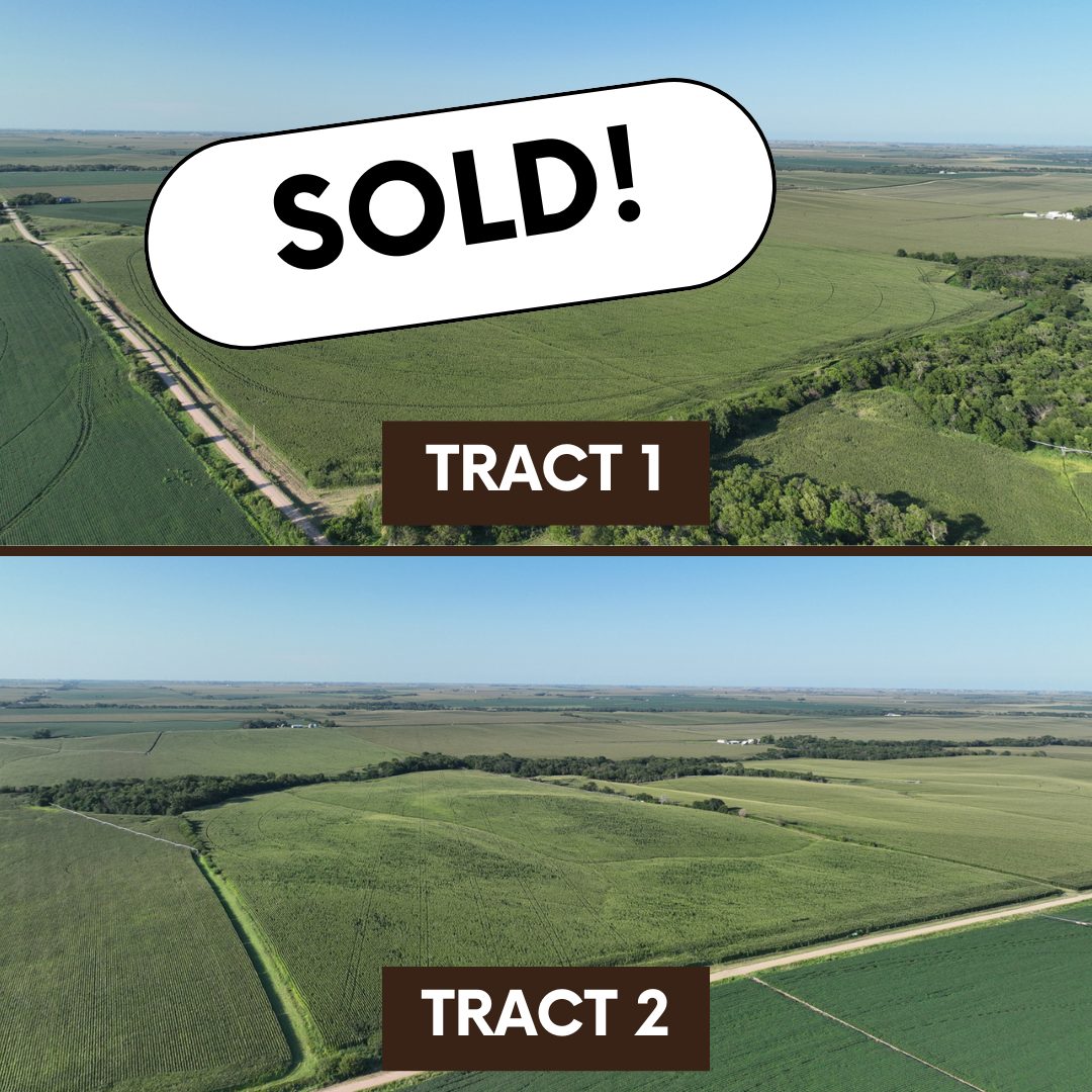
Tract 1
Legal Description – NW 1/4 Section 32, T9N, R6W
Property Taxes – $7,126.28
Total Acres (Per Assessor) – 158.03 +/-
• Irrigation Acres – 146.15 +/-
• Grassland Acres – 6.09 +/-
• Other Acres – 5.79 +/-
FSA Information – 149.34 Cropland Acres
• Corn – 145.69 Base Acres – 186 PLC Yield
• Total Base Acres – 145.69
Irrigation Information
Located in the Upper Big Blue NRD and has certified irrigation rights for 146.15 acres
Irrigation Equipment
• Well G-065021 – Drilled 6/2/05, 950 GPM, 30′ Static Level, 55′ Pumping Level, 130′ Well Depth
• 2023, 8-Tower Zimmatic Pivot with corner arm
• Natural gas motor is owned by tenant, Fertilizer tanks not included
Subject to 2025 lease and is open for the 2026 crop year.
Tract 2
Legal Description – E 1/2 of SW 1/4 Section 32, T9N, R6W
Property Taxes – $3,562.22
Total Acres (Per Assessor) – 79.58 +/-
• Irrigation Acres – 72.69 +/-
• Grassland Acres – 5.00 +/-
• Other Acres – 1.62 +/-
FSA Information – 75.09 Cropland Acres
• Corn – 73.25 Base Acres – 186 PLC Yield
• Total Base Acres – 73.25
Irrigation Information
• Located in the Upper Big Blue NRD and has certified irrigation rights for 72.96 acres
Irrigation Equipment
• Well G-065022 – Drilled 6/2/05, 800 GPM, 61′ Static Level, 90′ Pumping Level, 169′ Well Depth
• Older, 9-Tower Valley Pivot
• Propane motor is owned by tenant, Fertilizer tanks not included
Subject to 2025 lease and is open for the 2026 crop year.
Hamilton10/11 Auction
PROPERTY LOCATION
From the junction of Highway 34 and Highway 14, travel 11 miles south on Highway 14 to 2 Road. Continue 2 miles west to O Road. Tract 1 is located to the southeast of the intersection of O Road and 2 Road. Tract 2 is situated directly south of the eastern side of Tract 1.
Latitude: 40.709308 / Longitude: -98.030508
The information contained herein is as obtained by AgWest Land Brokers LLC—Holdrege, NE from the owner and other sources. Even though this information is considered reliable, neither broker nor owner make any guarantee, warranty or representation as to the correctness of any data or descriptions. The accuracy of such statements should be determined through independent investigation made by the prospective purchaser. This offer for sale is subject to prior sale, errors and omissions, change of price, terms or other conditions or withdrawal from sale in whole or in part, by seller without notice and at the sole discretion of seller. Readers are urged to form their own independent conclusions and evaluations in consultation with legal counsel, accountants, and/or investment advisors concerning any and all material contained herein. Maps are for illustrative purposes only and are not intended to represent actual property lines.
PROPERTY INFORMATION
Total Acres: 238
Irrigated Acres: 219
Grass Acres: 11
Taxes: $10,689
Mineral Rights: All mineral rights owned by seller, if any, convey to buyer.


